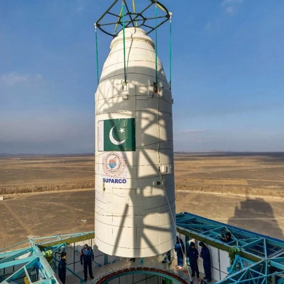
Pakistan has launched its first hyperspectral satellite HS1 from China’s Jiuquan Satellite Launch Centre, marking a major leap in the country’s space technology program. Developed by SUPARCO, the satellite will provide high-resolution data to boost agriculture, urban planning, environmental monitoring, and disaster management. The mission, part of SUPARCO Vision 2047, aims to enhance national self-reliance in space technology and strengthen Pakistan’s partnership with China in advanced scientific development.
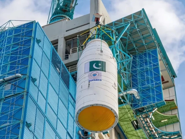
ISLAMABAD: Pakistan took a major leap in space technology on Sunday as it prepared to launch its first hyperspectral satellite HS1 into orbit from China’s Jiuquan Satellite Launch Centre (JSLC). The mission represents a landmark achievement in the country’s ongoing efforts to harness advanced space-based technologies for national development, environmental protection, and disaster management.
In an official statement, the Space and Upper Atmosphere Research Commission (SUPARCO) said the successful deployment of HS1 would “mark a new era in the development of space-based applications in agriculture, disaster management, urban development, and environmental monitoring.”
⸻
A Technological Milestone
The HS1 satellite is equipped with cutting-edge hyperspectral imaging sensors capable of capturing detailed data across hundreds of spectral bands. Unlike conventional satellites that rely on visible and infrared imaging, HS1 can detect subtle variations in light reflected from the Earth’s surface, enabling precise monitoring of natural and human-made changes.
SUPARCO described the mission as a “cornerstone in Pakistan’s pursuit of self-reliance in satellite technology and data applications.” The satellite’s deployment, conducted in collaboration with Chinese partners, also reflects the deepening technological cooperation between Islamabad and Beijing in the field of space exploration.
⸻
Precision Agriculture and Food Security
According to SUPARCO, one of HS1’s most critical applications will be in precision agriculture, an area of growing importance for Pakistan’s food security strategy. By analyzing spectral data, the satellite will assess crop health, soil moisture, and irrigation efficiency across the country’s vast agricultural zones.
“The satellite will provide detailed insights into crop health, soil moisture, and irrigation patterns,” the commission stated.
SUPARCO added that these insights are expected to improve crop yield estimation by 15 to 20 percent, enabling better resource management and supporting national food security initiatives.
Experts believe that HS1’s high-resolution data will help identify pest infestations, monitor drought conditions, and optimize water usage, which are essential steps toward sustainable farming in a country that faces frequent climate-induced agricultural challenges.
⸻
Urban Development and Environmental Monitoring
Beyond agriculture, HS1 will also play a vital role in urban planning and environmental management. The satellite’s imaging systems will provide valuable data for mapping infrastructure, monitoring pollution levels, and analyzing patterns of urban expansion across rapidly growing cities like Karachi, Lahore, and Islamabad.
SUPARCO highlighted that “the satellite will support sustainable city planning, land-use assessment, and efficient resource management.”
The data will also help policymakers monitor deforestation, industrial emissions, and coastline erosion, offering scientific support for climate resilience and environmental sustainability programs.
⸻
Disaster Management and Early Warning Systems
Another key focus of HS1’s mission is disaster management. Pakistan’s geography, marked by mountain ranges, river deltas, and seismic activity, makes it highly vulnerable to natural disasters. HS1’s advanced imaging capabilities will significantly strengthen early warning systems for floods, landslides, and earthquakes.
“HS1 will enhance disaster preparedness by providing timely data on floods, earthquakes, deforestation, and land degradation,” SUPARCO noted.
In the aftermath of disasters, the satellite’s data will enable rapid damage assessment and help authorities coordinate rescue and rehabilitation operations more efficiently.
⸻
Advancing Space Self-Reliance
The HS1 launch is part of Pakistan’s broader strategy to expand its remote sensing and satellite communication infrastructure under the National Space Policy and SUPARCO Vision 2047. These long-term programs aim to establish Pakistan as a regional hub for space science, research, and innovation.
SUPARCO stated that the mission “reflects Pakistan’s commitment to leveraging space technology for sustainable national development.”
The agency added that data from HS1 will be integrated into national development frameworks, empowering government departments, research institutions, and private sectors with high-quality geospatial information.
⸻
Strategic and Diplomatic Dimensions
The collaboration with China’s JSLC underscores the strategic depth of the Pakistan-China partnership, particularly in science and technology. Beijing has been instrumental in supporting Islamabad’s space ambitions, previously assisting in the launch of communication satellites such as PAKSAT 1R.
With HS1, Pakistan joins a select group of countries possessing hyperspectral imaging capability, a technology typically associated with advanced space powers such as the United States, China, and the European Union.
Discover more from JUST UNTOLD STORY
Subscribe to get the latest posts sent to your email.